Important Update: Google has withdrew some of the support for the programing feature, called “fusion tables”. The interactive map still functions but if there is a photo associated with the link, you must now click on that link to see
Remember “The Alamo” On Princess Hill
In about 1930, on the very top of Princess Hill a very unusual house for the area was constructed. This house was built by Caruthers “Colonel” Coleman (1894-1992). Caruthers was the co owner, with his sister Ruth Coleman Gay (1889-1958),
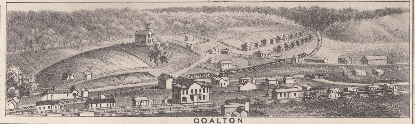
Lithograph of Scenes In And Around Ashland, KY
Here is a greatly reduced version of this lithograph as reproduced on page 10 in the publication “A History of Ashland, Kentucky 1876-1974” This publication was printed to help celebrate Ashland’s Centennial in 1954. Click on this image to get
70,000 Acre – William Grayson Tract of Land

Isaac Shelby, Kentucky’s first Governor, transferred much of the land in the Williams Creek Basin as one huge plot of 70,000 acres to William Grayson in mid 1795. This transfer was one of many in an early system to bureaucratically
Creeks, Branches, Runs, Forks, Hollows, Heads, and Mouths
Long before standardized governmental or postal assigned road, street, route names and numbers, people living in unincorporated communities needed a way to designate a particular place in their community. The utility of very specific place names is obvious. So, each
State and County Boundaries Are Not Constant
Let’s say we were born in Needmore Branch Hollow in the community of Rush (currently Needmore Road in Boyd County, KY) in 1775 and lived a long life there until we died in 1861 (86 years). The list below cites
Why a Website Devoted to the Williams Creek Basin?
I have always had a reasonable interest in history and geography especially with regard to the region I grew up in. This interest was not something that compelled me to spend a lot of time reading materials already available on