For attracting residents to the Williams Creek Basin (abbreviated WCB), the population boom from underground drift mining for coal within the WCB is likely unequaled. The large industrial scale coal mining operation that commenced at Coalton around 1865, instigated by
C&O Depot – Rush, KY – 1963
Click on the image above for a much larger version. In the last year or so I have seen a couple of copies of a very high quality image of the C&O Depot at Rush, KY floating about on the
“That Marshall Woman” In a Lonely Grave
I recently undertook a personal project to get GPS readings for the many small cemeteries in the Carter County section of the Williams Creek Basin. Even in this relatively small area this cemetery count is up to about 30. I
Upper and Lower Rush Schoolhouses, A Bit of a Mystery
Who knew that Rush, KY once had two separate elementary school districts? And, the schoolhouses for these two school districts were located less than one mile apart. One was “Upper Rush” and the other “Lower Rush”. Both were one room,
The New Row Water Pump
“New Row” was a row of 8 or 9 coal mining company houses in Rush, KY all facing SR 854. This group of houses all shared the exact same water source, one well with a hand pump. This pump supplied
The Many Graveyards of Straight Creek
About a month ago I was in the Williams Creek Basin area (abbreviated WCB) for a family visit and for fun I decided to drive around Straight Creek. This is likely the first time I had been on Straight Creek
The Williams Creek Basin Interactive Map
Important Update: Google has withdrew some of the support for the programing feature, called “fusion tables”. The interactive map still functions but if there is a photo associated with the link, you must now click on that link to see
Remember “The Alamo” On Princess Hill
In about 1930, on the very top of Princess Hill a very unusual house for the area was constructed. This house was built by Caruthers “Colonel” Coleman (1894-1992). Caruthers was the co owner, with his sister Ruth Coleman Gay (1889-1958),
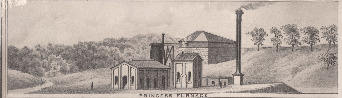
Lithograph of Scenes In And Around Ashland, KY
Here is a greatly reduced version of this lithograph as reproduced on page 10 in the publication “A History of Ashland, Kentucky 1876-1974” This publication was printed to help celebrate Ashland’s Centennial in 1954. Click on this image to get
70,000 Acre – William Grayson Tract of Land

Isaac Shelby, Kentucky’s first Governor, transferred much of the land in the Williams Creek Basin as one huge plot of 70,000 acres to William Grayson in mid 1795. This transfer was one of many in an early system to bureaucratically