Isaac Shelby, Kentucky’s first Governor, transferred much of the land in the Williams Creek Basin as one huge plot of 70,000 acres to William Grayson in mid 1795. This transfer was one of many in an early system to bureaucratically transfer lands in Kentucky from universal governmental ownership to private citizens. This 70,000 acre parcel was a 6 mile X 18 mile rectangle containing 108 square miles and stretched from west of Grayson, KY (named for William Grayson) to east of Rush.
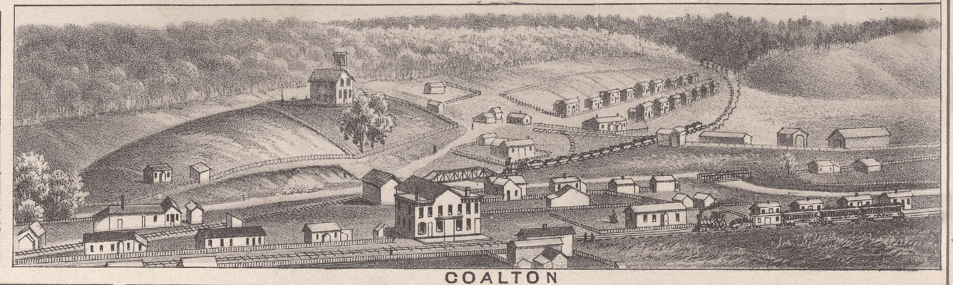
All of the communities in the Williams Creek Basin currently in Carter County, including Music, Grant, Norton Branch, Geigerville, Kilgore, and Star were in this plot – as were the communities of Rush and a large part of Coalton in Boyd County. The Boyd County communities of Princess, Straight Creek, and Buena Vista, and the northern part of Coalton closest to Princess were not in this parcel.
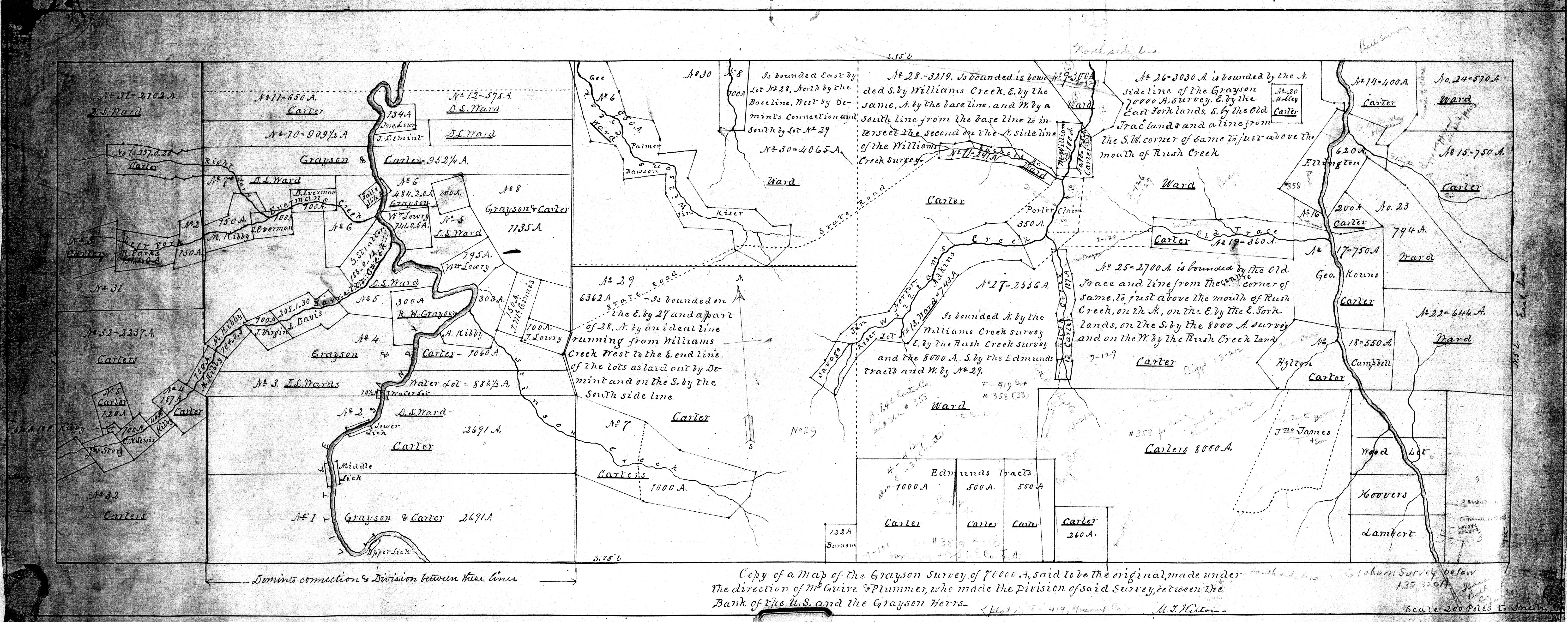
Here is an image of a map of this 70,000 acre tract from the Boyd County KY Clerks office. The larger waterway on the right side of this map is the East Fork of the Little Sandy River. Near the center of the map are Williams Creek, Rush Creek, and Rachael Branch. Rachael Branch is an early name for Star Branch. Wilson Creek is also shown near the middle. On the left side of the map the larger waterway is the Little Sandy River and some of its tributaries. Remember this tract is 6 miles X 18 miles in size. You can use these gross dimensions and the creek placement to have a good sense of where this tract is located and the area it covers. Click on this image for a larger view.
William Grayson (1740 – 1790) was a prominent Virginia soldier, lawyer, and statesman. He served as an aid to George Washington during the Revolutionary War, and commanded his own regiment in the Continental Army. He practiced law in Virginia and served as one of Virginia’s first Senators. He died in 1790 at 50 only one year into his Senatorial term.
The system for obtaining these 70,000 acres of land is often referred to using the very broad and imprecise terms “land grant”. Here are the exact mechanics of the particular system used to transfer this 70,000 acre plot.
The system consisted of three components:
· Warrant
· Survey
· Patent
Warrants were sold for a specified price, to particular individuals, for a particular sized plot. The warrant was not for a particular piece of land located in an exact place, but just a parcel of a specified size to be located somewhere in a large specified region. These warrants could be combined with other warrants to form larger parcels, sold to other individuals, or traded. These warrants could be used as part of the process to claim land somewhere in a specified area. But, obtaining a warrant was only the first step in obtaining ownership to land.
Surveyors, working as agents for those owning the warrants, would move into the general region specified by the warrant and survey a parcel of land consistent in size with the size specified on the warrant(s).
The warrant(s) and survey were then reviewed by the government. If the documentation was approved a “patent” was issued granting ownership of the land defined by the survey.
This 70,000 acre parcel consists of 9 distinct warrants.
All 9 of these warrants were issued to William Grayson by the state of Virginia on 12th Sept 1783, when Kentucky was still part of Virginia.
| Acres | Price in 1783 | ||
| 1 | 15 thousand | 24,000 Pounds | |
| 2 | 15 thousand | 24,000 Pounds | |
| 3 | 8 thousand | 12,800 Pounds | |
| 4 | 8 thousand | 12,800 Pounds | |
| 5 | 8 thousand | 12,800 Pounds | |
| 6 | 8 thousand | 12,800 Pounds | |
| 7 | 4 thousand | 6,400 Pounds | |
| 8 | 2 thousand | 3,200 Pounds | |
| 9 | 2 thousand | 3,200 Pounds | |
| 70 thousand | 112,000 Pounds |
The cost per acre in 1783 would have been 1.6 Pounds per acre or 1037 Pounds per square mile.
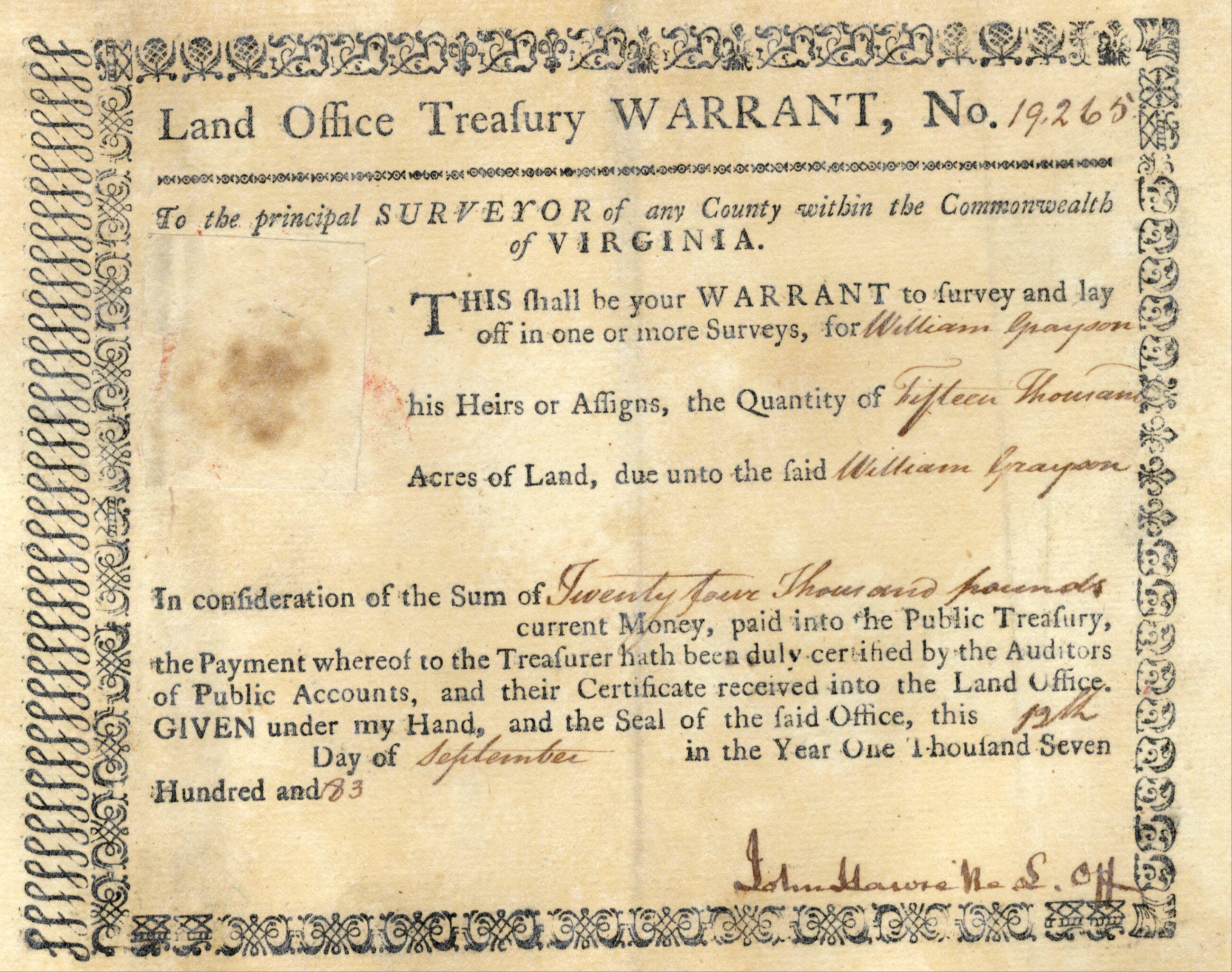
Here is an image of one representative warrant, #19265. Click on the image for a larger view.
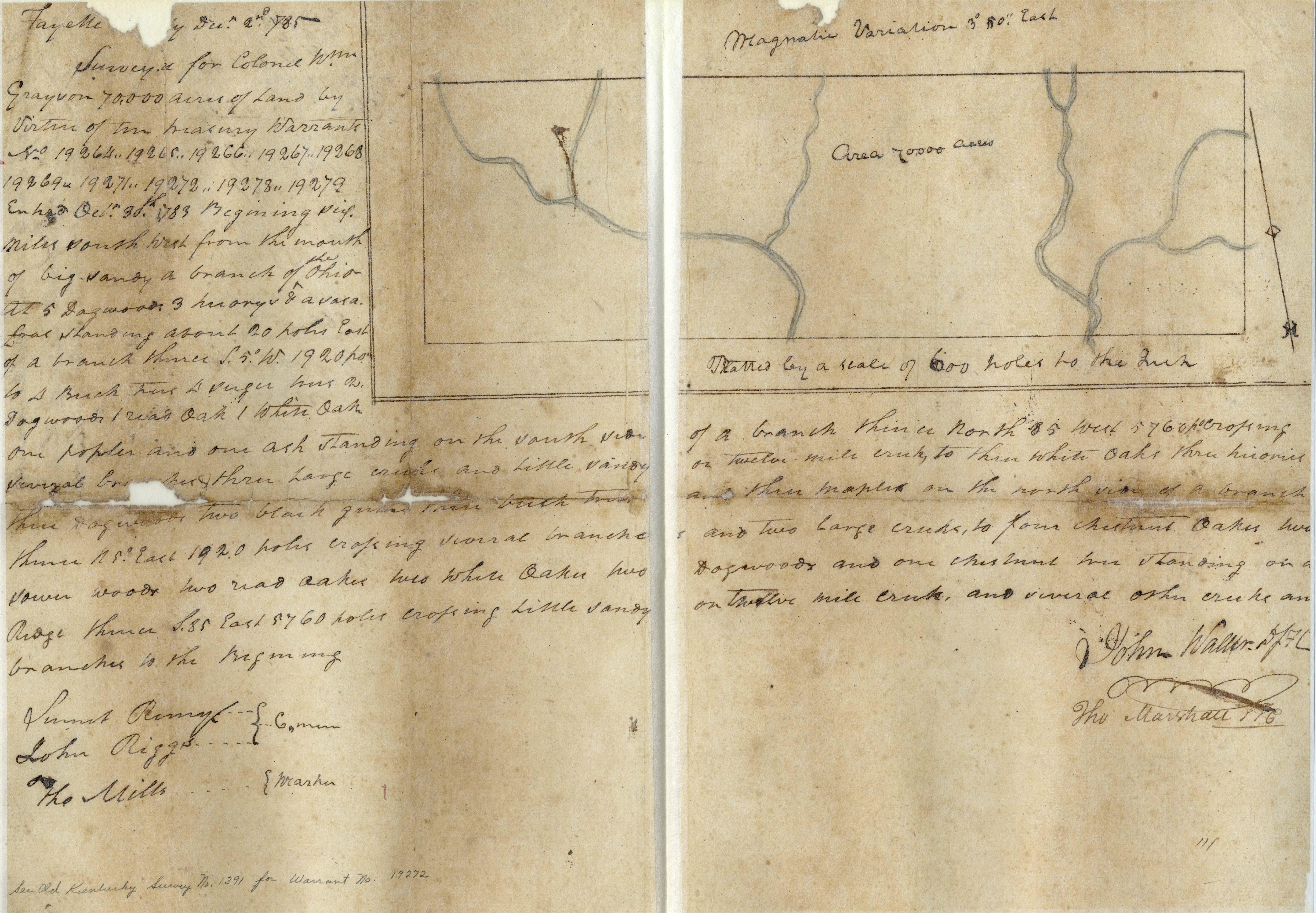
Here is the main page of the survey accomplished by John Walker. The survey is identified as “895” and dated in 1793 and 1794 on other pages of this survey. The “Thomas Marshall” that also signed this survey was the Surveyor General of Kentucky and Father of John Marshall, the first Chief Justice of the United States Supreme Court. Click on the image for a larger view.
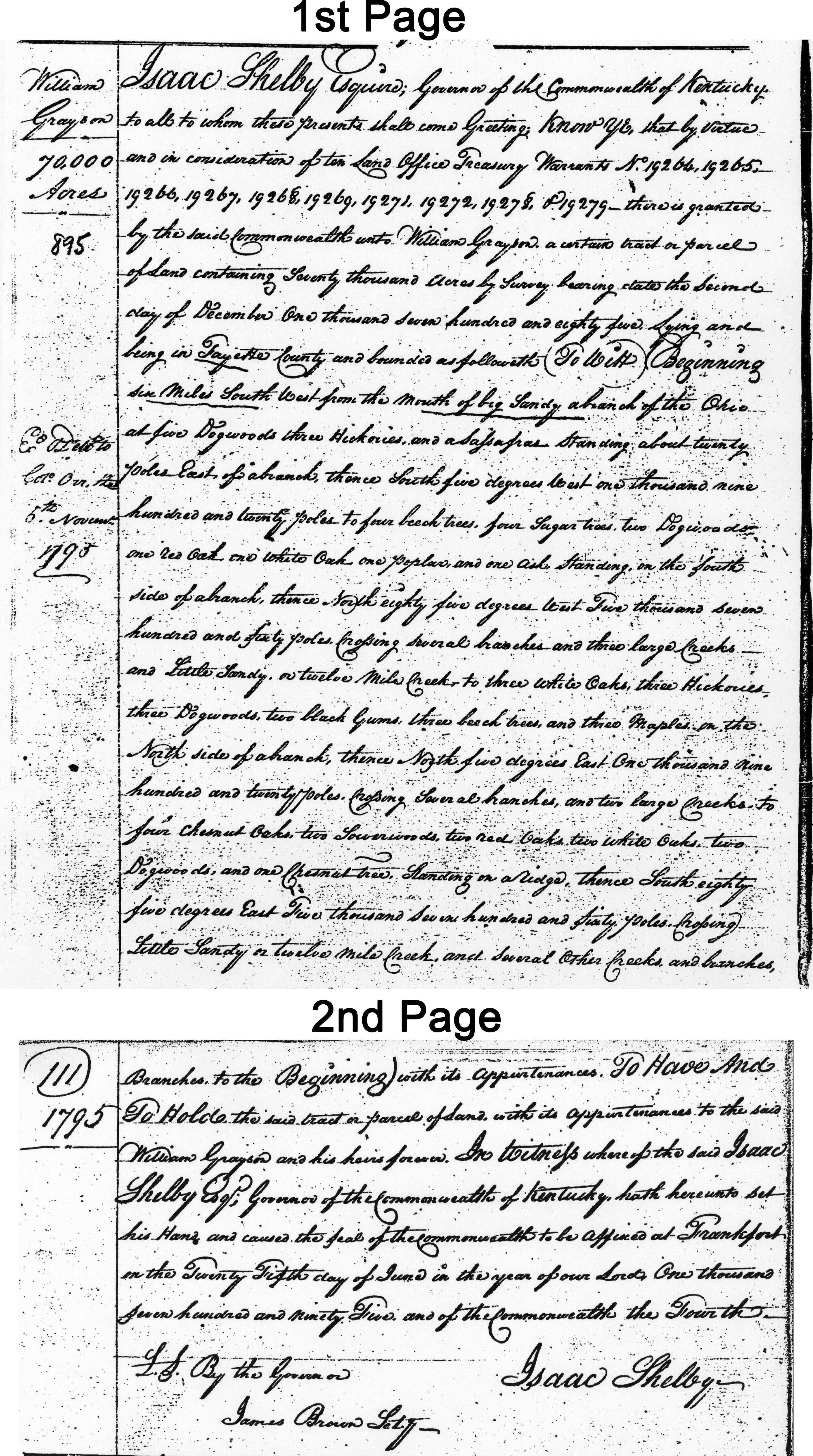
Here is Patent 895 signed by the Governor of Kentucky, Isaac Shelby, on 25 June 1795, about 12 years after the nine warrants cited in this patent were issued and 5 years after William Grayson died. This image is an edited composite of two distinct pages combined into one image. The “1st Page” and “2nd Page” labeling have been added to this image to differentiate the two distinct pages. Click on the image for a larger view.
All of the associated documents for this patent, labeled 0895.0 by the Kentucky Secretary of State’s Office, can be reviewed at this web link. Just page though all 24 of the individual images.
Images of all documents for Kentucky Patent OK 0895.0
William Grayson also received patents for other large tracts of land scattered in various other areas of Kentucky. Grayson County, Kentucky is also named for William Grayson. It is unlikely William Grayson ever actually saw any of these huge tracts of land in Kentucky.
I would like to personally thank Donald Cooke, Professional Engineer and Land Surveyor from Grayson, KY for is invaluable help and precise guidance in locating the map of this 70,000 acre plot at the Boyd County KY Clerks Office and for sharing his keen personal knowledge of these early land patents.
Next Article – Lithograph of Scenes In And Around Ashland, KY
Previous Article – Creeks, Branches, Runs, Forks, Hollows, Heads, and Mouths
References:
Boyd County Kentucky – County Clerks Office- Plat Maps
Kentucky Secretary of State Land Office Website for patent number OK 0895.0 – William Grayson
Wikipedia – “William Grayson” – https://en.wikipedia.org/wiki/William_Grayson
Wikipedia – “Thomas Marshall – https://en.wikipedia.org/wiki/Thomas_Marshall_%28U.S._politician%29
Thanks for Sharing. I wondered why or who Grayson was named after.
Great article