Important Update:
Google has withdrew some of the support for the programing feature, called “fusion tables”. The interactive map still functions but if there is a photo associated with the link, you must now click on that link to see the photo. This is just a minor annoyance.
This map covers the entire Williams Creek Basin (abbreviated WCB) with points of interest in all the various communities. Currently the map has about 150 points of interest in the WCB. Research is ongoing so many additional points will be added. Several additional graveyard locations will be added relatively soon.
If you are adventurous and want to jump directly into this interactive map without any background, jut click on the link immediately below. If you would rather have a bit of background and instruction start reading below this link.
Click here for the Williams Creek Basin Interactive Map
These map points are for many different types of places. Some are historic locations such as the locations of iron furnaces, mining facilities, schools, railroad stops, tunnels, important buildings, graveyards, churches, etc. Others are locations of basic geographic features such as hollows, creek confluence points, ponds, etc. Others points are cultural in nature such as the location of baseball fields, lodge halls, meeting places, etc.
Obviously knowing exactly were something was located is far more satisfying than just knowing that something existed somewhere in a general area. Well it is for me.
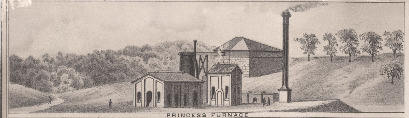
This map has icons at the map positions of interest. There are several different types of icons on the maps with each icon type standing for a particular type of feature. The three iron furnaces in the WCB have an icon that looks like a volcano (hey, I had to choose icons from a standardized icon menu). Locations of the confluence of the many area creeks have icons that look like water waves. Schools are a simple stylized building with a small flag on top. Churches look like schools, but with a cross on top, not a flag. Graveyards have stylized tombstone icons. Here is a general legend for the various icon types. Click on legend for a larger version.
![]()
When you click on one of the individual icons on the interactive map it brings up a menu with important information about that particular point. Many points also have photographs associated with that point. Currently about 30% of the points have associated photographs and I am actively trying to locate meaningful photographs for many of the other points. If you have such a photograph please contact me.
When you open the map it will be for the entire WCB and in many places there are so many icons they are jumbled on top of each other. Don’t panic. So, open the map and before you do anything just familiarize yourself with the basic area covered and get oriented and your bearings.
After you comprehend the general layout of the map you can move to a particular area of interest and zoom in on that area. When you zoom in this will spread the distance between the icons and you will be able to easily move around the area of interest and click on the individual icons to see that particular point’s information menu.
The map works mostly like any Google Map with features like satellite view, map view and street view. Satellite view is the default when the map is opened.
If you have used Google Maps before you will be right at home. If you have not used Google Maps before you will still be able to pick up the necessary map navigation rigor easily. Again, remember don’t panic.
Click here for the Williams Creek Basin Interactive Map
This map has been executed using a Google Maps mapping feature. With a bit of programming and attention one can really personalize the nature of the presented map.
The Williams Creek Basin Interactive Map can also be accessed via the “Maps” tab on the website navigation menu.
Next Article – The Many Graveyards of Straight Creek
Previous article – Remember “The Alamo” on Princess Hill
Good job, this is nice, found my house pretty easy. Well, it is covered by trees, but I found it. I own Leech or Leach, Station Baptist church, that was moved to this location, When 4 lane US 23 was put through, about, in the mid 60’s. Pretty near to the intersection of US 23, and I-64. across the hill from Ashland Oil.